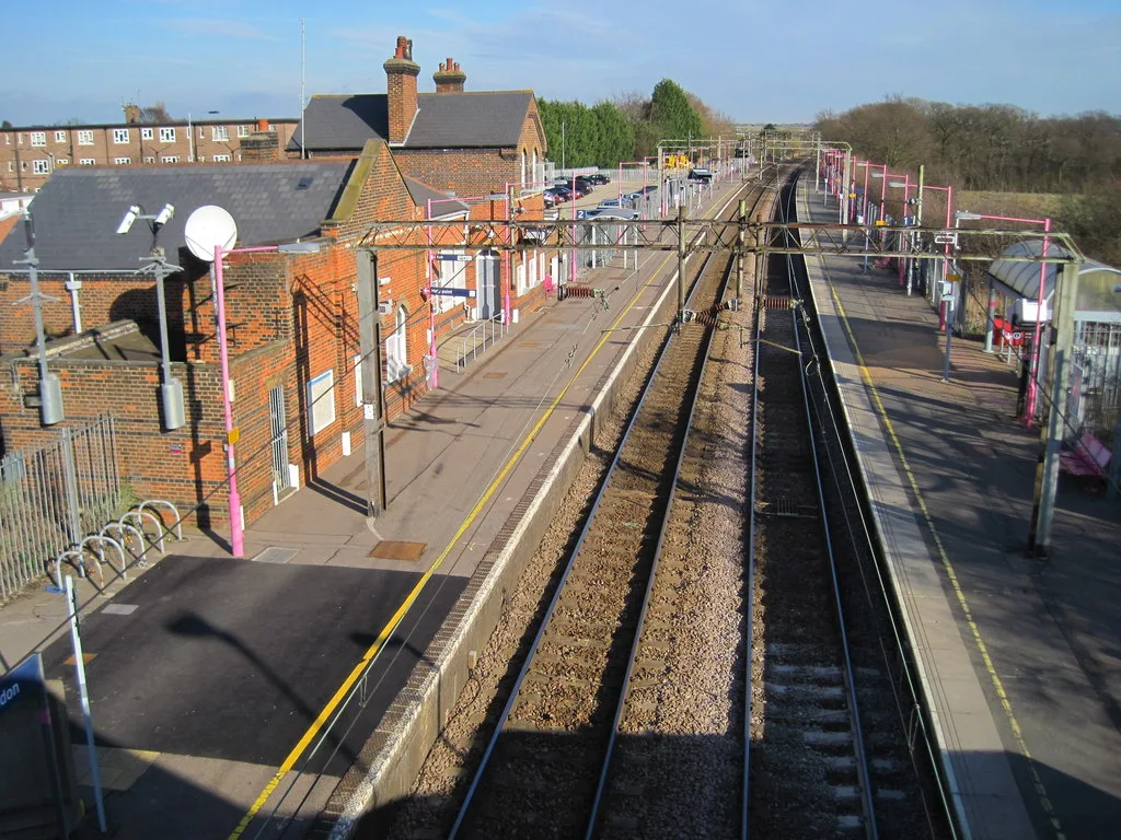

Dunton Hills has filed plans for its bus-only link to West Horndon station. Comments close 16 October; the parish council wants the first roads heard in public.
The developer of Dunton Hills Garden Village has asked Brentwood Borough Council to approve the first roads into the site. There are now two applications, and residents can still comment on the second one.
The second application covers the bus, walking and cycling entrance opposite Station Road in West Horndon, about four miles south of Brentwood town centre. It also covers the car-free road that would run from there to the new village centre. The council’s notice is dated 30 September, and its register gives 16 October as the closing date for neighbour comments (Brentwood Borough Council, 26/01016/REM).
The first application, for the main southern roundabout and the start of the spine road, is due to be decided by 15 October. West Horndon Parish Council has asked for it to be taken away from officers and decided by councillors in public.
What the new application asks for
The applicant is LIH Dunton Hills Ltd, and its planning documents now call the scheme Allwood. The application, reference 26/01016/REM, was validated on 10 September. It is the second of twelve “advanced infrastructure works” areas set out in the developer’s phasing plan, which went to the council on 19 June (Nexus Planning compliance statement, August 2026).
It covers four things:
- landscaping along the new footways, cycleways and the mobility corridor
- changes to the bus gate and the signalised junction at Station Road and Tilbury Road, the A128
- the mobility corridor itself, running from the bus gate east and then north, plus a footway and cycleway linking it to the start of the spine road
- temporary and permanent drainage for the new roads
A bus gate, not a road for cars
The outline permission marks this entrance for buses, pedestrians and cyclists only. The developer’s statement says that means no cars, taxis, delivery vans or bin lorries can use the bus gate or the corridor behind it.
The corridor would be a 6.75 metre shared surface with a 2 metre footway on each side. Cyclists would join the carriageway at the bus gate junction, which the statement says Essex County Council has accepted because the road will carry little traffic. One road for cars would cross it, on a raised table that gives the corridor priority.
At the A128 junction, the plans show:
- a toucan crossing for people on foot and bikes across the northern arm of the junction
- a 4 metre footway and cycleway on the east side of Tilbury Road, from the access to Old Mill Cottages to the bus gate, with a 3 metre verge
- a 4 metre footway and cycleway on the west side, also with a 3 metre verge
- two drainage basins on the east side of the A128, holding back road water before it reaches the Station Road ditch
The developer’s traffic modelling says every arm of the junction would run below 90% of its capacity in 2041, the year it tests.
The route has changed shape
The masterplan approved with the outline permission drew the corridor as a straight line from the bus gate to the village centre. The new plans turn it into what the statement calls a “reversed L”.
The developer’s reason is that a straight road cut across the site at an angle, leaving awkward building plots and needing cars to cross it more often. The statement says the borough council agreed the change complied with the masterplan’s rules in an email dated 2 April 2026.
The parish council’s objection to the first roads
The first application, 26/00711/REM, went in on 25 June. It covers the reconfigured southern access roundabout, the first stretch of spine road as far as the western side of the brook, and its drainage (Brentwood Borough Council, 26/00711/REM).
West Horndon Parish Council discussed it on 30 July. Its clerk wrote to the council the next day. The letter says:
- only three weeks were given to study 33 documents, and a request for more time was met with the suggestion that the applicant would not allow it
- the application is down for a decision by officers under delegated powers, which the parish council calls “strange and not in keeping with usual practice” for a scheme with such an effect on local roads
- nobody consulted the parish council or residents on the works, despite assurances from senior council managers that they would be involved
- the works boundary appears to cross into the gardens of at least two of the four Old Mill Cottages, with paths running beside them, which it calls “clearly unacceptable”
It asked for two things: that the application go to the Planning Committee, and that meetings be held with the parish council and residents.
Three neighbours objected as well. All three raise the cottages. One says a footpath now planned beside the A128 would run no more than 10 metres from their home and mean cutting back a hedge that screens the road.
What the cottages were promised
The buffer round Old Mill Cottages was argued over before the outline permission was issued. The parish council’s letter sets out the final wording of condition 7:
- no building within 50 metres of the cottages, other than outbuildings allowed under permitted development rights
- nothing next to the edge of that buffer taller than 9 metres
- nothing within 60 metres taller than 13.5 metres
The letter quotes a council planning officer telling the ward councillor in March that the detail would be looked at when reserved matters came in, and that the cottage owners would “absolutely” be involved in those discussions.
Thurrock Council, the neighbouring authority, has twice said it has no observations.
Where every Dunton Hills application stands
| Reference | What it is | Decision due by |
|---|---|---|
| 21/01525/DHVCON/1 | Tree works, site clearance and moving reptiles off site | 10 Oct 2026 |
| 21/01525/DHVCON/2 | Site-wide phasing plan | 10 Oct 2026 |
| 21/01525/DHVCON/3 | Construction waste plan | 14 Oct 2026 |
| 26/00711/REM | Southern roundabout and first spine road | 15 Oct 2026 |
| 21/01525/DHVCON/4 | Archaeological trial trenching | 7 Nov 2026 |
| 26/01016/REM | Bus gate, Station Road junction and mobility corridor | 10 Dec 2026 |
The first three were the subject of our August report, when their comment period was open. A seventh item, the developer’s outline business plan for managing the village, was closed with “no further action” on 11 September.
What building would look like
The construction traffic plan filed with the new application says lorries would use the existing site entrance off the A128 Tilbury Road. No new temporary access is needed. It also sets out delivery hours:
- Monday to Friday, 07:30 to 18:00
- Saturday, 08:00 to 13:00
- no deliveries on Sundays or public holidays
- avoiding 08:30 to 09:00 and 15:00 to 15:30 on weekdays where possible
The nearest part of the strategic road network is the A127, north of the site.
What it means for you
If you live in West Horndon or use the A128, the second application sets the design of the junction you will use for years. You can comment on 26/01016/REM:
- online through the council’s Public Access page for the application
- by email to planning@brentwood.gov.uk
- by post to Planning and Development Services, Brentwood Borough Council, Town Hall, Ingrave Road, Brentwood CM15 8AY
The register gives 16 October for neighbours. The newspaper notice gives 30 days from 30 September. Aim for the earlier date (Brentwood Borough Council notice, 30 September 2026).
The Planning Committee next meets on 13 October. Its agenda had not been published on 30 September, so it is not yet known whether the first roads application will be on it.
Decisions across the borough are tracked on our Brentwood planning news page.
Have your say